It has been suggested that the core of most successful prose is the road trip. Someone gets up, goes somewhere new, has adventures, sometimes returns home. And we find ourselves entertained by the process.
Or so I believed when I pitched to editors the idea of a Super Bowl road trip, back in 2005. It was the New England Patriots versus the Philadelphia Eagles in Super Bowl XXXIX, in Jacksonville, Fla.
I was intrigued by the notion of getting to the game from Southern California to the other side of the United States. By car.
Explaining the “hook” of the series took about 60 seconds. Actually driving it took six days.
However, my six-day Super Bowl series appears to have disappeared from online sources easily accessible to me. So, for this blog (which also may disappear over the course of 12 years) I will re-type the stories from the hard copies, which I picked up while staying in California.
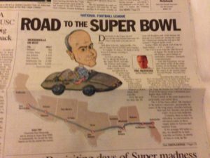
Here is Part 1, which appeared in the San Bernardino Sun on January 30, 2005. (That’s supposed to me, the guy with the big forehead in the little car, in the photo, above. Click on the image to get a better look at some of the statistics.)
Six more parts will appear over the next six days.
I recall the trip as great fun, and a fine way to have some long conversations with my daughter, watching the country roll by.
Seems long ago … and just the other day.
The story begins below.
Directions to the Super Bowl?
Get on the east-bound Interstate 10. Don’t stop until you run out of road.
And there you are: Jacksonville, Fla., site of Super Bowl XXXIX.
So simple. So direct. So hard to resist. Even if it means crossing a continent.
So we are giving in. We are taking the Road to the Super Bowl. Just like the Patriots and Eagles.
But where the football teams’ roads were metaphorical (a 16-game regular season, then the playoffs), ours is literal — some 2,400 miles from Ontario International Airport to downtown Jacksonville.
Over the next six days the 24-year-old daughter and I will attempt the passage in a rental car. Seeing the country’s landscape during the run-up to the country’s biggest sports event.
Seeing where the spinal cord of the Inland Empire — the I-10 — takes us.
The I-10 is to us what the Nile River is to Egypt. We dwell on its fertile fringes, and it brings us sustenance, business, transport communications.
And, like the Egyptians, we are only dimly aware of the outer reaches of our lifeline. What it looks like beyond the edges of our mental maps. Beyond Blythe. Beyond Tucson.
Reaching the other end of the I-10 shouldn’t be as hard as finding the sources of the Nile. Freeway all the way. No problem, with a co-driver, right?
Well, it is winter. Even in the Sunbelt states the I-10 slashes through, never too far from the border (or Gulf) of Mexico. Even if much of the route makes for a profoundly uneventful drive.
The I-10 has been called “the loneliest” of the nation’s interstates, presumably because of the long empty stretches between here and San Antonio, kjust past the road’s west-to-east midpoint.
Certainly there is time for reflection, or conversation, or advanced ennui, in those empty miles in Arizona and New Mexico and western Texas.
If we average 400 miles a day, we should be in Jacksonville on Friday, in plenty of time to soak up the atmosphere of this year’s Super Burg.
On the way, we will pass caverns and casinos, ghost towns and truck stops. Weigh stations and Border Patrol checkpoints. Deserts, mountains, hill country, swamps.
We shall see wide spots in the road, such as Buckeye, Ariz., and Fort Stockton, Texas. And metropolises such as Phoenix, Houston and New Orleans.
We will cross the continental divide, four time zones and seven states. We may even take a quick look into Mexico by walking across the Rio Grande, at El Paso.
The I-10 is part of the 46,726-mile national system, funded by the Federal-Aid Highway Act of 1956 — a project championed by President Eisenhower, who was impressed during World War II by the economic and military value of the German autobahn.
The U.S. system has three coast-to-coast crossings, and the I-10 (at 2,460 miles from the Santa Monica Pier to Jacksonville) actually is the shortest. The I-90 (Seattle to Boston) and the I-80 (San Francisco to Teaneck, N.J.) are 3,020 and 2,899 miles, respectively.
The I-10 cost $5 billion, in 1991 dollars. A bargain, as far as our lives are concerned, given the road’s enormous impact on the Inland Empire.
As we seek the 2005 football Jerusalem of Jacksonville, Super Bowl host for the first time, we will check regularly on Super Bowl enthusiasm. What do the folks in Quartzsite and Las Cruces and Beaumont and Mobile think? How excited are they in Pensacola and Tallahassee?
We plan to find out, en route.
We also plan to find out if the I-10 is dreary or dreamy. Endlessly fascinating or just plain endless.
The Road to the Super Bowl? It begins only a few miles from where most of us live. It ends at the Big Game. Just keep driving.


2 responses so far ↓
1 Doug // Jan 29, 2017 at 7:13 PM
I love road trip stories and am really looking forward to this series.
2 David // Jan 29, 2017 at 7:53 PM
I’ve driven half that route — the half that is essentially a thousand miles of dirt — a couple of times. I don’t really have any desire to drive it again. Will be interested to get your view of it.
Leave a Comment